Source List
API endpoint that allows TempSpatial objects to be viewed or edited.
GET /api/source/?format=api&offset=100&ordering=description
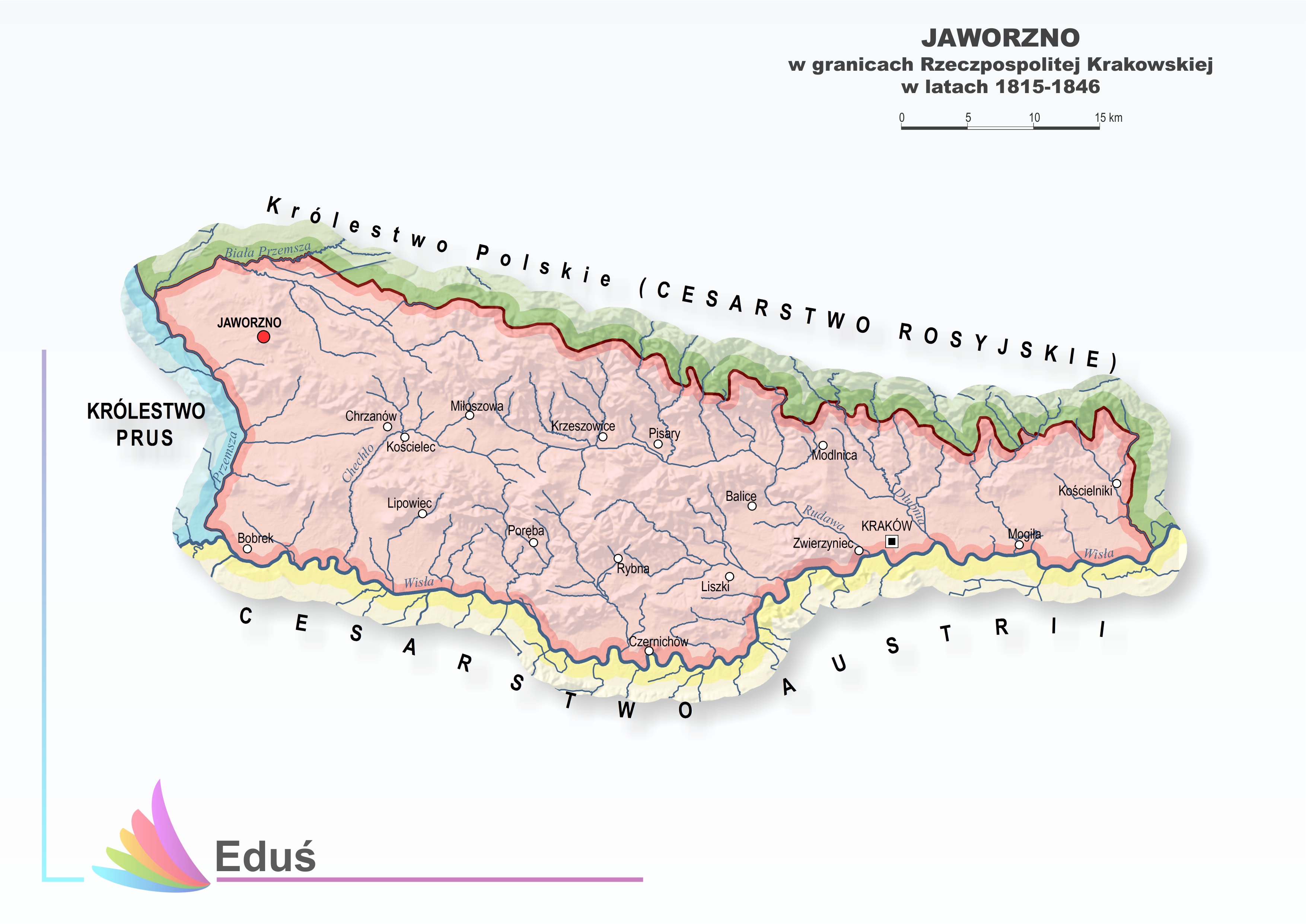
{ "count": 117, "next": null, "previous": "https://histogis.acdh.oeaw.ac.at/api/source/?format=api&limit=25&offset=75&ordering=description", "results": [ { "name": "Austro-Hungarian Empire Crownlands 1910", "description": "The basis of this data set is build on a map of Austria from 1835 by Anton Floder available through Sammlung Woldan. To adapt the data set and to provide widely harmonized data, also for the following decades, other historical maps were used as well for cross checking the borders and for data amendment. Following maps were used for comparing and adjusting the data set:\r\n\r\nKoenigreich Ungarn mit Kroazien, Slavonien, 1835 by Streit and Fischer (Rumsey Collection)\r\nBöhmen, Mähren und Osterreichisch-Schlesie, 1905 by Andree and Scobel (Rumsey Collection)\r\nKärnthen, Krain, Görz-Gradisca, Istrien, Triest, 1855 by Flemming (Rumsey Collection)\r\nGalizien, Ungarn und Nebenländer, 1868 by Kiepert (Rumsey Collection)\r\nDas Koenigreich Galizien, 1832 by Geographisches Institut (Weimar), Weiland (Rumsey Collection)\r\nOesterreich, 1849 by Radefeld (Rumsey Collection)\r\nJaworzno - w granicach Rzecpospolitej Krakowskiej w latach, 1815-1846\r\nDie Herzogthumer Steiermark, Karnten, Krain, 1866, Geographisches Institut (Weimar)\r\nUngarn, Galizien, 1855, by Kiepert (Rumsey Collection)\r\nOesterreich, 1856 by Czoernig (Woldan Collection)\r\nIn order to improve geometry accuracy also other available vector data sets were used and adapted, viz.: data provided by\r\n\r\nthe Mosaic Project, funded by the Austrian Science Fund (FWF) (Project Number: P 21257, http://www.censusmosaic.org/) and\r\nthe © OpenStreetMap collaborative project (www.openstreetmap.org).\r\nAnna Piechl was responsible for reviewing the existing, provided data sets, for data consolidation and harmonization, and for data editing based on research by Peter Paul Marckhgott-Sanabria. Peter Paul Marckhgott-Sanabria was responsible for historical investigation and validation, in particular for reviewing the created data sets, for data harmonization and for research on administrative structures in the time period and on the dates of existence of the respective administrative units (time spans between formation and disintegration).", "quote": "Anna Piechl / Peter Paul Marckhgott-Sanabria, \"Austrian Empire Crownlands 1910\", based on Woldan: Floder, Österreich, 1835; Census Mosaic: Europe Main, 1900; Rumsey: Andree, Scobel, Böhmen, 1905; Rumsey: Radefeld, Oesterreich, 1849; Rumsey: Streit, Ungarn, 1835; Rumsey: GI Weimar, Galizien, 1832; Rumsey: Andree, Böhmen, 1905; Rumsey: Flemming, Kärnthen, 1855; Eduś - IBR Biblioteki Śląskiej w Katowicach, Jaworzno, 2015; Woldan: Czoernig, Oesterreich, 1856 and © OpenStreetMap contributors; published by Histogis", "original_url": "http://sammlung.woldan.oeaw.ac.at/layers/geonode:ac03763400_oegqmst_oesterreich_gesamttitel_1835 http://www.censusmosaic.org/mosaic/tmp/download/europe_1900-2003.zip https://www.openstreetmap.org/; https://www.openstreetmap.org/copyright https://wambachers-osm.website/boundaries/ https://www.davidrumsey.com/luna/servlet/detail/RUMSEY~8~1~314315~90083474:Koenigreich-Ungarn-mit-Kroazien,-Sl?sort=Pub_List_No_InitialSort%2CPub_Date%2CPub_List_No%2CSeries_No&qvq=q:ungarn;sort:Pub_List_No_InitialSort%2CPub_Date%2CPub_List_No%2CSeries_No;lc:RUMSEY~8~1&mi=42&trs=150# https://www.davidrumsey.com/luna/servlet/detail/RUMSEY~8~1~239318~5511734:Bohmen,-Mahren-und-Osterreichisch-S?sort=pub_list_no_initialsort%2Cpub_date%2Cpub_list_no%2Cseries_no&qvq=q:mähren;sort:pub_list_no_initialsort%2Cpub_date%2Cpub_list_no%2Cseries_no;lc:RUMSEY~8~1&mi=6&trs=19# https://www.davidrumsey.com/luna/servlet/detail/RUMSEY~8~1~33462~1170948:Karnthen,-Krain,-Gorz-Gradisca,-Ist?sort=pub_list_no_initialsort%2Cpub_date%2Cpub_list_no%2Cseries_no&qvq=q:karnthen;sort:pub_list_no_initialsort%2Cpub_date%2Cpub_list_no%2Cseries_no;lc:RUMSEY~8~1&mi=4&trs=5 https://www.davidrumsey.com/luna/servlet/detail/RUMSEY~8~1~303778~90074534:Galizien,-Ungarn-und-Nebenlander?sort=Pub_List_No_InitialSort%2CPub_Date%2CPub_List_No%2CSeries_No&qvq=q:ungarn;sort:Pub_List_No_InitialSort%2CPub_Date%2CPub_List_No%2CSeries_No;lc:RUMSEY~8~1&mi=41&trs=150 https://www.davidrumsey.com/luna/servlet/detail/RUMSEY~8~1~280029~90053299:Das-Koenigreich-Galizien--Kingdom-o?sort=pub_list_no_initialsort%2Cpub_date%2Cpub_list_no%2Cseries_no&qvq=w4s:/when%2F1832;q:galizien;sort:pub_list_no_initialsort%2Cpub_date%2Cpub_list_no%2Cseries_no;lc:RUMSEY~8~1&mi=0&trs=1 https://www.davidrumsey.com/luna/servlet/detail/RUMSEY~8~1~21892~680048:Composite--Oesterreich-?sort=Pub_List_No_InitialSort%2CPub_Date%2CPub_List_No%2CSeries_No&qvq=q:enns;sort:Pub_List_No_InitialSort%2CPub_Date%2CPub_List_No%2CSeries_No;lc:RUMSEY~8~1&mi=12&trs=207 http://edus.ibrbs.pl/wp-content/uploads/2016/07/Mapa_16.jpg https://www.davidrumsey.com/luna/servlet/detail/RUMSEY~8~1~265853~90040373:Die-Herzogthumer-Steiermark,-Karnte?sort=Pub_List_No_InitialSort%2CPub_Date%2CPub_List_No%2CSeries_No&qvq=q:krain;sort:Pub_List_No_InitialSort%2CPub_Date%2CPub_List_No%2CSeries_No;lc:RUMSEY~8~1&mi=12&trs=18 https://www.davidrumsey.com/luna/servlet/detail/RUMSEY~8~1~24743~950007:Ungarn,-Galizien-?sort=Pub_List_No_InitialSort%2CPub_Date%2CPub_List_No%2CSeries_No&qvq=w4s:/when%2F1855;q:kiepert;sort:Pub_List_No_InitialSort%2CPub_Date%2CPub_List_No%2CSeries_No;lc:RUMSEY~8~1&mi=0&trs=12 http://sammlung.woldan.oeaw.ac.at/layers/geonode:ac03793289_czoernig_oesterreich_1856" }, { "name": "Austrian Empire Crownlands 1851", "description": "The basis of this data set is build on a map of Austria from 1835 by Anton Floder available through Sammlung Woldan. To adapt the data set and to provide widely harmonized data, also for the following decades, other historical maps were used as well for cross checking the borders and for data amendment. Following maps were used for comparing and adjusting the data set:\r\n\r\nKoenigreich Ungarn mit Kroazien, Slavonien, 1835 by Streit and Fischer (Rumsey Collection)\r\nBöhmen, Mähren und Osterreichisch-Schlesie, 1905 by Andree and Scobel (Rumsey Collection)\r\nKärnthen, Krain, Görz-Gradisca, Istrien, Triest, 1855 by Flemming (Rumsey Collection)\r\nGalizien, Ungarn und Nebenländer, 1868 by Kiepert (Rumsey Collection)\r\nDas Koenigreich Galizien, 1832 by Geographisches Institut (Weimar), Weiland (Rumsey Collection)\r\nOesterreich, 1849 by Radefeld (Rumsey Collection)\r\nJaworzno - w granicach Rzecpospolitej Krakowskiej w latach, 1815-1846\r\nDie Herzogthumer Steiermark, Karnten, Krain, 1866, Geographisches Institut (Weimar)\r\nUngarn, Galizien, 1855, by Kiepert (Rumsey Collection)\r\nOesterreich, 1856 by Czoernig (Woldan Collection)\r\nIn order to improve geometry accuracy also other available vector data sets were used and adapted, viz.: data provided by\r\n\r\nthe Mosaic Project, funded by the Austrian Science Fund (FWF) (Project Number: P 21257, http://www.censusmosaic.org/) and\r\nthe © OpenStreetMap collaborative project (www.openstreetmap.org).\r\nAnna Piechl was responsible for reviewing the existing, provided data sets, for data consolidation and harmonization, and for data editing based on research by Peter Paul Marckhgott-Sanabria. Peter Paul Marckhgott-Sanabria was responsible for historical investigation and validation, in particular for reviewing the created data sets, for data harmonization and for research on administrative structures in the time period and on the dates of existence of the respective administrative units (time spans between formation and disintegration).", "quote": "Anna Piechl / Peter Paul Marckhgott-Sanabria, \"Austrian Empire Crownlands 1851\", based on Woldan: Floder, Österreich, 1835; Census Mosaic: Europe Main, 1900; Rumsey: Andree, Scobel, Böhmen, 1905; Rumsey: Radefeld, Oesterreich, 1849; Rumsey: Streit, Ungarn, 1835; Rumsey: GI Weimar, Galizien, 1832; Rumsey: Andree, Böhmen, 1905; Rumsey: Flemming, Kärnthen, 1855; Eduś - IBR Biblioteki Śląskiej w Katowicach, Jaworzno, 2015; Woldan: Czoernig, Oesterreich, 1856 and © OpenStreetMap contributors; published by Histogis", "original_url": "http://sammlung.woldan.oeaw.ac.at/layers/geonode:ac03763400_oegqmst_oesterreich_gesamttitel_1835 http://www.censusmosaic.org/mosaic/tmp/download/europe_1900-2003.zip https://www.openstreetmap.org/; https://www.openstreetmap.org/copyright https://wambachers-osm.website/boundaries/ https://www.davidrumsey.com/luna/servlet/detail/RUMSEY~8~1~314315~90083474:Koenigreich-Ungarn-mit-Kroazien,-Sl?sort=Pub_List_No_InitialSort%2CPub_Date%2CPub_List_No%2CSeries_No&qvq=q:ungarn;sort:Pub_List_No_InitialSort%2CPub_Date%2CPub_List_No%2CSeries_No;lc:RUMSEY~8~1&mi=42&trs=150# https://www.davidrumsey.com/luna/servlet/detail/RUMSEY~8~1~239318~5511734:Bohmen,-Mahren-und-Osterreichisch-S?sort=pub_list_no_initialsort%2Cpub_date%2Cpub_list_no%2Cseries_no&qvq=q:mähren;sort:pub_list_no_initialsort%2Cpub_date%2Cpub_list_no%2Cseries_no;lc:RUMSEY~8~1&mi=6&trs=19# https://www.davidrumsey.com/luna/servlet/detail/RUMSEY~8~1~33462~1170948:Karnthen,-Krain,-Gorz-Gradisca,-Ist?sort=pub_list_no_initialsort%2Cpub_date%2Cpub_list_no%2Cseries_no&qvq=q:karnthen;sort:pub_list_no_initialsort%2Cpub_date%2Cpub_list_no%2Cseries_no;lc:RUMSEY~8~1&mi=4&trs=5 https://www.davidrumsey.com/luna/servlet/detail/RUMSEY~8~1~303778~90074534:Galizien,-Ungarn-und-Nebenlander?sort=Pub_List_No_InitialSort%2CPub_Date%2CPub_List_No%2CSeries_No&qvq=q:ungarn;sort:Pub_List_No_InitialSort%2CPub_Date%2CPub_List_No%2CSeries_No;lc:RUMSEY~8~1&mi=41&trs=150 https://www.davidrumsey.com/luna/servlet/detail/RUMSEY~8~1~280029~90053299:Das-Koenigreich-Galizien--Kingdom-o?sort=pub_list_no_initialsort%2Cpub_date%2Cpub_list_no%2Cseries_no&qvq=w4s:/when%2F1832;q:galizien;sort:pub_list_no_initialsort%2Cpub_date%2Cpub_list_no%2Cseries_no;lc:RUMSEY~8~1&mi=0&trs=1 https://www.davidrumsey.com/luna/servlet/detail/RUMSEY~8~1~21892~680048:Composite--Oesterreich-?sort=Pub_List_No_InitialSort%2CPub_Date%2CPub_List_No%2CSeries_No&qvq=q:enns;sort:Pub_List_No_InitialSort%2CPub_Date%2CPub_List_No%2CSeries_No;lc:RUMSEY~8~1&mi=12&trs=207 http://edus.ibrbs.pl/wp-content/uploads/2016/07/Mapa_16.jpg https://www.davidrumsey.com/luna/servlet/detail/RUMSEY~8~1~265853~90040373:Die-Herzogthumer-Steiermark,-Karnte?sort=Pub_List_No_InitialSort%2CPub_Date%2CPub_List_No%2CSeries_No&qvq=q:krain;sort:Pub_List_No_InitialSort%2CPub_Date%2CPub_List_No%2CSeries_No;lc:RUMSEY~8~1&mi=12&trs=18 https://www.davidrumsey.com/luna/servlet/detail/RUMSEY~8~1~24743~950007:Ungarn,-Galizien-?sort=Pub_List_No_InitialSort%2CPub_Date%2CPub_List_No%2CSeries_No&qvq=w4s:/when%2F1855;q:kiepert;sort:Pub_List_No_InitialSort%2CPub_Date%2CPub_List_No%2CSeries_No;lc:RUMSEY~8~1&mi=0&trs=12 http://sammlung.woldan.oeaw.ac.at/layers/geonode:ac03793289_czoernig_oesterreich_1856" }, { "name": "Austro-Hungarian Empire Crownlands 1870", "description": "The basis of this data set is build on a map of Austria from 1835 by Anton Floder available through Sammlung Woldan. To adapt the data set and to provide widely harmonized data, also for the following decades, other historical maps were used as well for cross checking the borders and for data amendment. Following maps were used for comparing and adjusting the data set:\r\n\r\nKoenigreich Ungarn mit Kroazien, Slavonien, 1835 by Streit and Fischer (Rumsey Collection)\r\nBöhmen, Mähren und Osterreichisch-Schlesie, 1905 by Andree and Scobel (Rumsey Collection)\r\nKärnthen, Krain, Görz-Gradisca, Istrien, Triest, 1855 by Flemming (Rumsey Collection)\r\nGalizien, Ungarn und Nebenländer, 1868 by Kiepert (Rumsey Collection)\r\nDas Koenigreich Galizien, 1832 by Geographisches Institut (Weimar), Weiland (Rumsey Collection)\r\nOesterreich, 1849 by Radefeld (Rumsey Collection)\r\nJaworzno - w granicach Rzecpospolitej Krakowskiej w latach, 1815-1846\r\nDie Herzogthumer Steiermark, Karnten, Krain, 1866, Geographisches Institut (Weimar)\r\nUngarn, Galizien, 1855, by Kiepert (Rumsey Collection)\r\nOesterreich, 1856 by Czoernig (Woldan Collection)\r\nIn order to improve geometry accuracy also other available vector data sets were used and adapted, viz.: data provided by\r\n\r\nthe Mosaic Project, funded by the Austrian Science Fund (FWF) (Project Number: P 21257, http://www.censusmosaic.org/) and\r\nthe © OpenStreetMap collaborative project (www.openstreetmap.org).\r\nAnna Piechl was responsible for reviewing the existing, provided data sets, for data consolidation and harmonization, and for data editing based on research by Peter Paul Marckhgott-Sanabria. Peter Paul Marckhgott-Sanabria was responsible for historical investigation and validation, in particular for reviewing the created data sets, for data harmonization and for research on administrative structures in the time period and on the dates of existence of the respective administrative units (time spans between formation and disintegration).", "quote": "Anna Piechl / Peter Paul Marckhgott-Sanabria, \"Austrian Empire Crownlands 1870\", based on Woldan: Floder, Österreich, 1835; Census Mosaic: Europe Main, 1900; Rumsey: Andree, Scobel, Böhmen, 1905; Rumsey: Radefeld, Oesterreich, 1849; Rumsey: Streit, Ungarn, 1835; Rumsey: GI Weimar, Galizien, 1832; Rumsey: Andree, Böhmen, 1905; Rumsey: Flemming, Kärnthen, 1855; Eduś - IBR Biblioteki Śląskiej w Katowicach, Jaworzno, 2015; Woldan: Czoernig, Oesterreich, 1856 and © OpenStreetMap contributors; published by Histogis", "original_url": "http://sammlung.woldan.oeaw.ac.at/layers/geonode:ac03763400_oegqmst_oesterreich_gesamttitel_1835 http://www.censusmosaic.org/mosaic/tmp/download/europe_1900-2003.zip https://www.openstreetmap.org/; https://www.openstreetmap.org/copyright https://wambachers-osm.website/boundaries/ https://www.davidrumsey.com/luna/servlet/detail/RUMSEY~8~1~314315~90083474:Koenigreich-Ungarn-mit-Kroazien,-Sl?sort=Pub_List_No_InitialSort%2CPub_Date%2CPub_List_No%2CSeries_No&qvq=q:ungarn;sort:Pub_List_No_InitialSort%2CPub_Date%2CPub_List_No%2CSeries_No;lc:RUMSEY~8~1&mi=42&trs=150# https://www.davidrumsey.com/luna/servlet/detail/RUMSEY~8~1~239318~5511734:Bohmen,-Mahren-und-Osterreichisch-S?sort=pub_list_no_initialsort%2Cpub_date%2Cpub_list_no%2Cseries_no&qvq=q:mähren;sort:pub_list_no_initialsort%2Cpub_date%2Cpub_list_no%2Cseries_no;lc:RUMSEY~8~1&mi=6&trs=19# https://www.davidrumsey.com/luna/servlet/detail/RUMSEY~8~1~33462~1170948:Karnthen,-Krain,-Gorz-Gradisca,-Ist?sort=pub_list_no_initialsort%2Cpub_date%2Cpub_list_no%2Cseries_no&qvq=q:karnthen;sort:pub_list_no_initialsort%2Cpub_date%2Cpub_list_no%2Cseries_no;lc:RUMSEY~8~1&mi=4&trs=5 https://www.davidrumsey.com/luna/servlet/detail/RUMSEY~8~1~303778~90074534:Galizien,-Ungarn-und-Nebenlander?sort=Pub_List_No_InitialSort%2CPub_Date%2CPub_List_No%2CSeries_No&qvq=q:ungarn;sort:Pub_List_No_InitialSort%2CPub_Date%2CPub_List_No%2CSeries_No;lc:RUMSEY~8~1&mi=41&trs=150 https://www.davidrumsey.com/luna/servlet/detail/RUMSEY~8~1~280029~90053299:Das-Koenigreich-Galizien--Kingdom-o?sort=pub_list_no_initialsort%2Cpub_date%2Cpub_list_no%2Cseries_no&qvq=w4s:/when%2F1832;q:galizien;sort:pub_list_no_initialsort%2Cpub_date%2Cpub_list_no%2Cseries_no;lc:RUMSEY~8~1&mi=0&trs=1 https://www.davidrumsey.com/luna/servlet/detail/RUMSEY~8~1~21892~680048:Composite--Oesterreich-?sort=Pub_List_No_InitialSort%2CPub_Date%2CPub_List_No%2CSeries_No&qvq=q:enns;sort:Pub_List_No_InitialSort%2CPub_Date%2CPub_List_No%2CSeries_No;lc:RUMSEY~8~1&mi=12&trs=207 http://edus.ibrbs.pl/wp-content/uploads/2016/07/Mapa_16.jpg https://www.davidrumsey.com/luna/servlet/detail/RUMSEY~8~1~265853~90040373:Die-Herzogthumer-Steiermark,-Karnte?sort=Pub_List_No_InitialSort%2CPub_Date%2CPub_List_No%2CSeries_No&qvq=q:krain;sort:Pub_List_No_InitialSort%2CPub_Date%2CPub_List_No%2CSeries_No;lc:RUMSEY~8~1&mi=12&trs=18 https://www.davidrumsey.com/luna/servlet/detail/RUMSEY~8~1~24743~950007:Ungarn,-Galizien-?sort=Pub_List_No_InitialSort%2CPub_Date%2CPub_List_No%2CSeries_No&qvq=w4s:/when%2F1855;q:kiepert;sort:Pub_List_No_InitialSort%2CPub_Date%2CPub_List_No%2CSeries_No;lc:RUMSEY~8~1&mi=0&trs=12 http://sammlung.woldan.oeaw.ac.at/layers/geonode:ac03793289_czoernig_oesterreich_1856" }, { "name": "Austrian Empire Crownlands 1860", "description": "The basis of this data set is build on a map of Austria from 1835 by Anton Floder available through Sammlung Woldan. To adapt the data set and to provide widely harmonized data, also for the following decades, other historical maps were used as well for cross checking the borders and for data amendment. Following maps were used for comparing and adjusting the data set:\r\n\r\nKoenigreich Ungarn mit Kroazien, Slavonien, 1835 by Streit and Fischer (Rumsey Collection)\r\nBöhmen, Mähren und Osterreichisch-Schlesie, 1905 by Andree and Scobel (Rumsey Collection)\r\nKärnthen, Krain, Görz-Gradisca, Istrien, Triest, 1855 by Flemming (Rumsey Collection)\r\nGalizien, Ungarn und Nebenländer, 1868 by Kiepert (Rumsey Collection)\r\nDas Koenigreich Galizien, 1832 by Geographisches Institut (Weimar), Weiland (Rumsey Collection)\r\nOesterreich, 1849 by Radefeld (Rumsey Collection)\r\nJaworzno - w granicach Rzecpospolitej Krakowskiej w latach, 1815-1846\r\nDie Herzogthumer Steiermark, Karnten, Krain, 1866, Geographisches Institut (Weimar)\r\nUngarn, Galizien, 1855, by Kiepert (Rumsey Collection)\r\nOesterreich, 1856 by Czoernig (Woldan Collection)\r\nIn order to improve geometry accuracy also other available vector data sets were used and adapted, viz.: data provided by\r\n\r\nthe Mosaic Project, funded by the Austrian Science Fund (FWF) (Project Number: P 21257, http://www.censusmosaic.org/) and\r\nthe © OpenStreetMap collaborative project (www.openstreetmap.org).\r\nAnna Piechl was responsible for reviewing the existing, provided data sets, for data consolidation and harmonization, and for data editing based on research by Peter Paul Marckhgott-Sanabria. Peter Paul Marckhgott-Sanabria was responsible for historical investigation and validation, in particular for reviewing the created data sets, for data harmonization and for research on administrative structures in the time period and on the dates of existence of the respective administrative units (time spans between formation and disintegration).", "quote": "Anna Piechl / Peter Paul Marckhgott-Sanabria, \"Austrian Empire Crownlands 1860\", based on Woldan: Floder, Österreich, 1835; Census Mosaic: Europe Main, 1900; Rumsey: Andree, Scobel, Böhmen, 1905; Rumsey: Radefeld, Oesterreich, 1849; Rumsey: Streit, Ungarn, 1835; Rumsey: GI Weimar, Galizien, 1832; Rumsey: Andree, Böhmen, 1905; Rumsey: Flemming, Kärnthen, 1855; Eduś - IBR Biblioteki Śląskiej w Katowicach, Jaworzno, 2015; Woldan: Czoernig, Oesterreich, 1856 and © OpenStreetMap contributors; published by Histogis", "original_url": "http://sammlung.woldan.oeaw.ac.at/layers/geonode:ac03763400_oegqmst_oesterreich_gesamttitel_1835 http://www.censusmosaic.org/mosaic/tmp/download/europe_1900-2003.zip https://www.openstreetmap.org/; https://www.openstreetmap.org/copyright https://wambachers-osm.website/boundaries/ https://www.davidrumsey.com/luna/servlet/detail/RUMSEY~8~1~314315~90083474:Koenigreich-Ungarn-mit-Kroazien,-Sl?sort=Pub_List_No_InitialSort%2CPub_Date%2CPub_List_No%2CSeries_No&qvq=q:ungarn;sort:Pub_List_No_InitialSort%2CPub_Date%2CPub_List_No%2CSeries_No;lc:RUMSEY~8~1&mi=42&trs=150# https://www.davidrumsey.com/luna/servlet/detail/RUMSEY~8~1~239318~5511734:Bohmen,-Mahren-und-Osterreichisch-S?sort=pub_list_no_initialsort%2Cpub_date%2Cpub_list_no%2Cseries_no&qvq=q:mähren;sort:pub_list_no_initialsort%2Cpub_date%2Cpub_list_no%2Cseries_no;lc:RUMSEY~8~1&mi=6&trs=19# https://www.davidrumsey.com/luna/servlet/detail/RUMSEY~8~1~33462~1170948:Karnthen,-Krain,-Gorz-Gradisca,-Ist?sort=pub_list_no_initialsort%2Cpub_date%2Cpub_list_no%2Cseries_no&qvq=q:karnthen;sort:pub_list_no_initialsort%2Cpub_date%2Cpub_list_no%2Cseries_no;lc:RUMSEY~8~1&mi=4&trs=5 https://www.davidrumsey.com/luna/servlet/detail/RUMSEY~8~1~303778~90074534:Galizien,-Ungarn-und-Nebenlander?sort=Pub_List_No_InitialSort%2CPub_Date%2CPub_List_No%2CSeries_No&qvq=q:ungarn;sort:Pub_List_No_InitialSort%2CPub_Date%2CPub_List_No%2CSeries_No;lc:RUMSEY~8~1&mi=41&trs=150 https://www.davidrumsey.com/luna/servlet/detail/RUMSEY~8~1~280029~90053299:Das-Koenigreich-Galizien--Kingdom-o?sort=pub_list_no_initialsort%2Cpub_date%2Cpub_list_no%2Cseries_no&qvq=w4s:/when%2F1832;q:galizien;sort:pub_list_no_initialsort%2Cpub_date%2Cpub_list_no%2Cseries_no;lc:RUMSEY~8~1&mi=0&trs=1 https://www.davidrumsey.com/luna/servlet/detail/RUMSEY~8~1~21892~680048:Composite--Oesterreich-?sort=Pub_List_No_InitialSort%2CPub_Date%2CPub_List_No%2CSeries_No&qvq=q:enns;sort:Pub_List_No_InitialSort%2CPub_Date%2CPub_List_No%2CSeries_No;lc:RUMSEY~8~1&mi=12&trs=207 http://edus.ibrbs.pl/wp-content/uploads/2016/07/Mapa_16.jpg https://www.davidrumsey.com/luna/servlet/detail/RUMSEY~8~1~265853~90040373:Die-Herzogthumer-Steiermark,-Karnte?sort=Pub_List_No_InitialSort%2CPub_Date%2CPub_List_No%2CSeries_No&qvq=q:krain;sort:Pub_List_No_InitialSort%2CPub_Date%2CPub_List_No%2CSeries_No;lc:RUMSEY~8~1&mi=12&trs=18 https://www.davidrumsey.com/luna/servlet/detail/RUMSEY~8~1~24743~950007:Ungarn,-Galizien-?sort=Pub_List_No_InitialSort%2CPub_Date%2CPub_List_No%2CSeries_No&qvq=w4s:/when%2F1855;q:kiepert;sort:Pub_List_No_InitialSort%2CPub_Date%2CPub_List_No%2CSeries_No;lc:RUMSEY~8~1&mi=0&trs=12 http://sammlung.woldan.oeaw.ac.at/layers/geonode:ac03793289_czoernig_oesterreich_1856" }, { "name": "Austrian Empire Crownlands 1849", "description": "The basis of this data set is build on a map of Austria from 1835 by Anton Floder available through Sammlung Woldan. To adapt the data set and to provide widely harmonized data, also for the following decades, other historical maps were used as well for cross checking the borders and for data amendment. Following maps were used for comparing and adjusting the data set:\r\n\r\nKoenigreich Ungarn mit Kroazien, Slavonien, 1835 by Streit and Fischer (Rumsey Collection)\r\nBöhmen, Mähren und Osterreichisch-Schlesie, 1905 by Andree and Scobel (Rumsey Collection)\r\nKärnthen, Krain, Görz-Gradisca, Istrien, Triest, 1855 by Flemming (Rumsey Collection)\r\nGalizien, Ungarn und Nebenländer, 1868 by Kiepert (Rumsey Collection)\r\nDas Koenigreich Galizien, 1832 by Geographisches Institut (Weimar), Weiland (Rumsey Collection)\r\nOesterreich, 1849 by Radefeld (Rumsey Collection)\r\nJaworzno - w granicach Rzecpospolitej Krakowskiej w latach, 1815-1846\r\nIn order to improve geometry accuracy also other available vector data sets were used and adapted, viz.: data provided by\r\n\r\nthe Mosaic Project, funded by the Austrian Science Fund (FWF) (Project Number: P 21257, http://www.censusmosaic.org/) and\r\nthe © OpenStreetMap collaborative project (www.openstreetmap.org).\r\nAnna Piechl was responsible for reviewing the existing, provided data sets, for data consolidation and harmonization, and for data editing based on research by Peter Paul Marckhgott-Sanabria. Peter Paul Marckhgott-Sanabria was responsible for historical investigation and validation, in particular for reviewing the created data sets, for data harmonization and for research on administrative structures in the time period and on the dates of existence of the respective administrative units (time spans between formation and disintegration).", "quote": "Anna Piechl / Peter Paul Marckhgott-Sanabria, \"Austrian Empire Crownlands 1849\", based on Woldan: Floder, Österreich, 1835; Census Mosaic: Europe Main, 1900; Rumsey: Andree, Scobel, Böhmen, 1905; Rumsey: Radefeld, Oesterreich, 1849; Rumsey: Streit, Ungarn, 1835; Rumsey: GI Weimar, Galizien, 1832; Rumsey: Andree, Böhmen, 1905; Rumsey: Flemming, Kärnthen, 1855; Eduś - IBR Biblioteki Śląskiej w Katowicach, Jaworzno, 2015 and © OpenStreetMap contributors; published by Histogis", "original_url": "http://sammlung.woldan.oeaw.ac.at/layers/geonode:ac03763400_oegqmst_oesterreich_gesamttitel_1835 http://www.censusmosaic.org/mosaic/tmp/download/europe_1900-2003.zip https://www.openstreetmap.org/; https://www.openstreetmap.org/copyright https://wambachers-osm.website/boundaries/ https://www.davidrumsey.com/luna/servlet/detail/RUMSEY~8~1~314315~90083474:Koenigreich-Ungarn-mit-Kroazien,-Sl?sort=Pub_List_No_InitialSort%2CPub_Date%2CPub_List_No%2CSeries_No&qvq=q:ungarn;sort:Pub_List_No_InitialSort%2CPub_Date%2CPub_List_No%2CSeries_No;lc:RUMSEY~8~1&mi=42&trs=150# https://www.davidrumsey.com/luna/servlet/detail/RUMSEY~8~1~239318~5511734:Bohmen,-Mahren-und-Osterreichisch-S?sort=pub_list_no_initialsort%2Cpub_date%2Cpub_list_no%2Cseries_no&qvq=q:mähren;sort:pub_list_no_initialsort%2Cpub_date%2Cpub_list_no%2Cseries_no;lc:RUMSEY~8~1&mi=6&trs=19# https://www.davidrumsey.com/luna/servlet/detail/RUMSEY~8~1~33462~1170948:Karnthen,-Krain,-Gorz-Gradisca,-Ist?sort=pub_list_no_initialsort%2Cpub_date%2Cpub_list_no%2Cseries_no&qvq=q:karnthen;sort:pub_list_no_initialsort%2Cpub_date%2Cpub_list_no%2Cseries_no;lc:RUMSEY~8~1&mi=4&trs=5 https://www.davidrumsey.com/luna/servlet/detail/RUMSEY~8~1~303778~90074534:Galizien,-Ungarn-und-Nebenlander?sort=Pub_List_No_InitialSort%2CPub_Date%2CPub_List_No%2CSeries_No&qvq=q:ungarn;sort:Pub_List_No_InitialSort%2CPub_Date%2CPub_List_No%2CSeries_No;lc:RUMSEY~8~1&mi=41&trs=150 https://www.davidrumsey.com/luna/servlet/detail/RUMSEY~8~1~280029~90053299:Das-Koenigreich-Galizien--Kingdom-o?sort=pub_list_no_initialsort%2Cpub_date%2Cpub_list_no%2Cseries_no&qvq=w4s:/when%2F1832;q:galizien;sort:pub_list_no_initialsort%2Cpub_date%2Cpub_list_no%2Cseries_no;lc:RUMSEY~8~1&mi=0&trs=1 https://www.davidrumsey.com/luna/servlet/detail/RUMSEY~8~1~21892~680048:Composite--Oesterreich-?sort=Pub_List_No_InitialSort%2CPub_Date%2CPub_List_No%2CSeries_No&qvq=q:enns;sort:Pub_List_No_InitialSort%2CPub_Date%2CPub_List_No%2CSeries_No;lc:RUMSEY~8~1&mi=12&trs=207 http://edus.ibrbs.pl/wp-content/uploads/2016/07/Mapa_16.jpg" }, { "name": "Austrian Empire Crownlands 1815", "description": "The basis of this data set is build on a map of Austria from 1835 by Anton Floder available through Sammlung Woldan. To adapt the data set and to provide widely harmonized data, also for the following decades, other historical maps were used as well for cross checking the borders and for data amendment. Following maps were used for comparing and adjusting the data set:\r\n\r\nKoenigreich Ungarn mit Kroazien, Slavonien, 1835 by Streit and Fischer (Rumsey Collection)\r\nBöhmen, Mähren und Osterreichisch-Schlesie, 1905 by Andree and Scobel (Rumsey Collection)\r\nKärnthen, Krain, Görz-Gradisca, Istrien, Triest, 1855 by Flemming (Rumsey Collection)\r\nGalizien, Ungarn und Nebenländer, 1868 by Kiepert (Rumsey Collection)\r\nDas Koenigreich Galizien, 1832 by Geographisches Institut (Weimar), Weiland (Rumsey Collection)\r\nOesterreich, 1849 by Radefeld (Rumsey Collection)\r\nJaworzno - w granicach Rzecpospolitej Krakowskiej w latach, 1815-1846\r\nIn order to improve geometry accuracy also other available vector data sets were used and adapted, viz.: data provided by\r\n\r\nthe Mosaic Project, funded by the Austrian Science Fund (FWF) (Project Number: P 21257, http://www.censusmosaic.org/) and\r\nthe © OpenStreetMap collaborative project (www.openstreetmap.org).\r\nAnna Piechl was responsible for reviewing the existing, provided data sets, for data consolidation and harmonization, and for data editing based on research by Peter Paul Marckhgott-Sanabria. Peter Paul Marckhgott-Sanabria was responsible for historical investigation and validation, in particular for reviewing the created data sets, for data harmonization and for research on administrative structures in the time period and on the dates of existence of the respective administrative units (time spans between formation and disintegration).", "quote": "Anna Piechl / Peter Paul Marckhgott-Sanabria, \"Austrian Empire Crownlands 1848\", based on Woldan: Floder, Österreich, 1835; Census Mosaic: Europe Main, 1900; Rumsey: Andree, Scobel, Böhmen, 1905; Rumsey: Radefeld, Oesterreich, 1849; Rumsey: Streit, Ungarn, 1835; Rumsey: GI Weimar, Galizien, 1832; Rumsey: Andree, Böhmen, 1905; Rumsey: Flemming, Kärnthen, 1855; 2015 and © OpenStreetMap contributors; published by Histogis", "original_url": "http://sammlung.woldan.oeaw.ac.at/layers/geonode:ac03763400_oegqmst_oesterreich_gesamttitel_1835 http://www.censusmosaic.org/mosaic/tmp/download/europe_1900-2003.zip https://www.openstreetmap.org/; https://www.openstreetmap.org/copyright https://wambachers-osm.website/boundaries/ https://www.davidrumsey.com/luna/servlet/detail/RUMSEY~8~1~314315~90083474:Koenigreich-Ungarn-mit-Kroazien,-Sl?sort=Pub_List_No_InitialSort%2CPub_Date%2CPub_List_No%2CSeries_No&qvq=q:ungarn;sort:Pub_List_No_InitialSort%2CPub_Date%2CPub_List_No%2CSeries_No;lc:RUMSEY~8~1&mi=42&trs=150# https://www.davidrumsey.com/luna/servlet/detail/RUMSEY~8~1~239318~5511734:Bohmen,-Mahren-und-Osterreichisch-S?sort=pub_list_no_initialsort%2Cpub_date%2Cpub_list_no%2Cseries_no&qvq=q:mähren;sort:pub_list_no_initialsort%2Cpub_date%2Cpub_list_no%2Cseries_no;lc:RUMSEY~8~1&mi=6&trs=19# https://www.davidrumsey.com/luna/servlet/detail/RUMSEY~8~1~33462~1170948:Karnthen,-Krain,-Gorz-Gradisca,-Ist?sort=pub_list_no_initialsort%2Cpub_date%2Cpub_list_no%2Cseries_no&qvq=q:karnthen;sort:pub_list_no_initialsort%2Cpub_date%2Cpub_list_no%2Cseries_no;lc:RUMSEY~8~1&mi=4&trs=5 https://www.davidrumsey.com/luna/servlet/detail/RUMSEY~8~1~303778~90074534:Galizien,-Ungarn-und-Nebenlander?sort=Pub_List_No_InitialSort%2CPub_Date%2CPub_List_No%2CSeries_No&qvq=q:ungarn;sort:Pub_List_No_InitialSort%2CPub_Date%2CPub_List_No%2CSeries_No;lc:RUMSEY~8~1&mi=41&trs=150 https://www.davidrumsey.com/luna/servlet/detail/RUMSEY~8~1~280029~90053299:Das-Koenigreich-Galizien--Kingdom-o?sort=pub_list_no_initialsort%2Cpub_date%2Cpub_list_no%2Cseries_no&qvq=w4s:/when%2F1832;q:galizien;sort:pub_list_no_initialsort%2Cpub_date%2Cpub_list_no%2Cseries_no;lc:RUMSEY~8~1&mi=0&trs=1 https://www.davidrumsey.com/luna/servlet/detail/RUMSEY~8~1~21892~680048:Composite--Oesterreich-?sort=Pub_List_No_InitialSort%2CPub_Date%2CPub_List_No%2CSeries_No&qvq=q:enns;sort:Pub_List_No_InitialSort%2CPub_Date%2CPub_List_No%2CSeries_No;lc:RUMSEY~8~1&mi=12&trs=207" }, { "name": "Austrian Empire Crownlands 1848", "description": "The basis of this data set is build on a map of Austria from 1835 by Anton Floder available through Sammlung Woldan. To adapt the data set and to provide widely harmonized data, also for the following decades, other historical maps were used as well for cross checking the borders and for data amendment. Following maps were used for comparing and adjusting the data set:\r\n\r\nKoenigreich Ungarn mit Kroazien, Slavonien, 1835 by Streit and Fischer (Rumsey Collection)\r\nBöhmen, Mähren und Osterreichisch-Schlesie, 1905 by Andree and Scobel (Rumsey Collection)\r\nKärnthen, Krain, Görz-Gradisca, Istrien, Triest, 1855 by Flemming (Rumsey Collection)\r\nGalizien, Ungarn und Nebenländer, 1868 by Kiepert (Rumsey Collection)\r\nDas Koenigreich Galizien, 1832 by Geographisches Institut (Weimar), Weiland (Rumsey Collection)\r\nOesterreich, 1849 by Radefeld (Rumsey Collection)\r\nJaworzno - w granicach Rzecpospolitej Krakowskiej w latach, 1815-1846\r\nIn order to improve geometry accuracy also other available vector data sets were used and adapted, viz.: data provided by\r\n\r\nthe Mosaic Project, funded by the Austrian Science Fund (FWF) (Project Number: P 21257, http://www.censusmosaic.org/) and\r\nthe © OpenStreetMap collaborative project (www.openstreetmap.org).\r\nAnna Piechl was responsible for reviewing the existing, provided data sets, for data consolidation and harmonization, and for data editing based on research by Peter Paul Marckhgott-Sanabria. Peter Paul Marckhgott-Sanabria was responsible for historical investigation and validation, in particular for reviewing the created data sets, for data harmonization and for research on administrative structures in the time period and on the dates of existence of the respective administrative units (time spans between formation and disintegration).", "quote": "Anna Piechl / Peter Paul Marckhgott-Sanabria, \"Austrian Empire Crownlands 1848\", based on Woldan: Floder, Österreich, 1835; Census Mosaic: Europe Main, 1900; Rumsey: Andree, Scobel, Böhmen, 1905; Rumsey: Radefeld, Oesterreich, 1849; Rumsey: Streit, Ungarn, 1835; Rumsey: GI Weimar, Galizien, 1832; Rumsey: Andree, Böhmen, 1905; Rumsey: Flemming, Kärnthen, 1855; Eduś - IBR Biblioteki Śląskiej w Katowicach, Jaworzno, 2015 and © OpenStreetMap contributors; published by Histogis", "original_url": "http://sammlung.woldan.oeaw.ac.at/layers/geonode:ac03763400_oegqmst_oesterreich_gesamttitel_1835 http://www.censusmosaic.org/mosaic/tmp/download/europe_1900-2003.zip https://www.openstreetmap.org/; https://www.openstreetmap.org/copyright https://wambachers-osm.website/boundaries/ https://www.davidrumsey.com/luna/servlet/detail/RUMSEY~8~1~314315~90083474:Koenigreich-Ungarn-mit-Kroazien,-Sl?sort=Pub_List_No_InitialSort%2CPub_Date%2CPub_List_No%2CSeries_No&qvq=q:ungarn;sort:Pub_List_No_InitialSort%2CPub_Date%2CPub_List_No%2CSeries_No;lc:RUMSEY~8~1&mi=42&trs=150# https://www.davidrumsey.com/luna/servlet/detail/RUMSEY~8~1~239318~5511734:Bohmen,-Mahren-und-Osterreichisch-S?sort=pub_list_no_initialsort%2Cpub_date%2Cpub_list_no%2Cseries_no&qvq=q:mähren;sort:pub_list_no_initialsort%2Cpub_date%2Cpub_list_no%2Cseries_no;lc:RUMSEY~8~1&mi=6&trs=19# https://www.davidrumsey.com/luna/servlet/detail/RUMSEY~8~1~33462~1170948:Karnthen,-Krain,-Gorz-Gradisca,-Ist?sort=pub_list_no_initialsort%2Cpub_date%2Cpub_list_no%2Cseries_no&qvq=q:karnthen;sort:pub_list_no_initialsort%2Cpub_date%2Cpub_list_no%2Cseries_no;lc:RUMSEY~8~1&mi=4&trs=5 https://www.davidrumsey.com/luna/servlet/detail/RUMSEY~8~1~303778~90074534:Galizien,-Ungarn-und-Nebenlander?sort=Pub_List_No_InitialSort%2CPub_Date%2CPub_List_No%2CSeries_No&qvq=q:ungarn;sort:Pub_List_No_InitialSort%2CPub_Date%2CPub_List_No%2CSeries_No;lc:RUMSEY~8~1&mi=41&trs=150 https://www.davidrumsey.com/luna/servlet/detail/RUMSEY~8~1~280029~90053299:Das-Koenigreich-Galizien--Kingdom-o?sort=pub_list_no_initialsort%2Cpub_date%2Cpub_list_no%2Cseries_no&qvq=w4s:/when%2F1832;q:galizien;sort:pub_list_no_initialsort%2Cpub_date%2Cpub_list_no%2Cseries_no;lc:RUMSEY~8~1&mi=0&trs=1 https://www.davidrumsey.com/luna/servlet/detail/RUMSEY~8~1~21892~680048:Composite--Oesterreich-?sort=Pub_List_No_InitialSort%2CPub_Date%2CPub_List_No%2CSeries_No&qvq=q:enns;sort:Pub_List_No_InitialSort%2CPub_Date%2CPub_List_No%2CSeries_No;lc:RUMSEY~8~1&mi=12&trs=207 http://edus.ibrbs.pl/wp-content/uploads/2016/07/Mapa_16.jpg" }, { "name": "Vienna Suburbs Quarters 1843", "description": "The data set is based on a map from Georg Bauerkeller (Bauerkeller, Wien, 1843) from David Rumsey Collection (https://www.davidrumsey.com) See cited below.\r\n\r\nTo increase spatial accuracy boundaries were compared with OpenStreetMap basemap.\r\n\r\nAnna Piechl was responsible for data editing. Peter Paul Marckhgott-Sanabria was responsible for historical investigation and validation.", "quote": "Anna Piechl / Peter Paul Marckhgott-Sanabria, \"Vienna Suburbs Quarters 1843\", based on Rumsey: Bauerkeller, Wien, 1843 and © OpenStreetMap contributors, published by HistoGIS", "original_url": "https://www.davidrumsey.com/luna/servlet/detail/RUMSEY~8~1~291085~90062658:Neuester-Plan-von-Wien-und-Dessen-3?sort=Pub_List_No_InitialSort%2CPub_Date%2CPub_List_No%2CSeries_No#\r\nhttps://www.openstreetmap.org/copyright/" }, { "name": "Austrian Empire Counties 1850", "description": "The data set is based on an already existing HistoGIS data set 'austrian_empire_adm3_counties_1835' with its basis data provided by Peter Teibenbacher and his project \"Der Erste Demografische Übergang in Österreich 1869-1937\" (funded by the Austrian Science Fund (FWF), Project Number P 21157). The data set from 1835 was adopted and modified so that it corresponds to the counties of the period from 1850 - 1854. Moreover, data from the Census Mosaic Project (http://www.censusmosaic.org/) was used to add missing information to the attribute table. All counties were checked (in particular with regard to dates of existence) by means of historical legislative texts provided by the Austrian National Library, available online through ALEX: http://alex.onb.ac.at/. Other helpful sources were diploma theses on the territorial development of the former crown lands of the Habsburg Monarchy (see quoted below).\r\n\r\nTo improve spatial accuracy, data provided by the © OpenStreetMap collaborative project (www.openstreetmap.org) and georeferenced historical maps were used. The historical maps also served as sources of names.\r\n\r\nThe starting date of the circles dates back to the new political division from 1849. Ending dates come along with another political reform which took place in 1854. Although some district authorities were dissolved earlier. Start - and end dates refer to the listed laws.\r\n\r\nSmaller crown lands were not divided into circles, in order to obtain a complete data set these are included in the data set. This affects the following crown lands: Kärnten, Krain, Schlesien, Bukowina, Salzburg, Österreich ob der Enns, Österreich unter der Enns, Dalmatien, Kroatien und Slawonien\r\n\r\nRemark: The reconstruction of some borders turned out to be very difficult due to a lack of information and small scale maps. In case of doubt, the reconstructed border line refers to the cited historical map.\r\n\r\nOnly few sources are available for Hungary, the Hungarian crown lands and the military border, so there are no exact start and end dates. Legal texts could not be found. The borders are based on a map by Carl Flemming (Rumsey: Flemming, Ungarn, 1855).\r\n\r\nAnna Piechl was responsible for data vectorization, consolidation and harmonization, and for data amendment and editing based on research by Peter Paul Marckhgott-Sanabria and Norbert Czirjak.\r\nPeter Paul Marckhgott-Sanabria was responsible for historical investigation and validation, in particular for reviewing the created data sets and for research on administrative structures in the time period and on the dates of existence of the respective administrative units (time spans between formation and disintegration).", "quote": "Anna Piechl / Peter Paul Marckhgott-Sanabria, \"Austrian Empire Counties 1850\", based on Woldan: Floder, Österreich, 1835; Rumsey: Flemming et al., Tyrol, 1855; Rumsey: Flemming et al., Bohmen, 1855, Rumsey: Flemming et al., Mahren, 1855; Straka, Steiermark, 1978; Rumsey: Flemming et al., Galizien, 1855; Rumsey: Flemming et al., Karnthen, 1855; Rumsey: Felmming et al., Ungarn, 1855; Klöcker, Oberösterreich, 2011; Wutte, Niederösterreich, 2015; Emmer, Tirol, 2010; Zernig, Bukowina, 2012; Walter, Kärnten, 2013, Mohorko, Mähren, 2011; Auer, Böhmen, 2011; and © OpenStreetMap contributors; published by HistoGIS", "original_url": "http://sammlung.woldan.oeaw.ac.at/layers/geonode:ac03763400_oegqmst_oesterreich_gesamttitel_1835\r\nhttps://www.openstreetmap.org/; https://www.openstreetmap.org/copyright\r\nhttps://www.davidrumsey.com/luna/servlet/detail/RUMSEY~8~1~33464~1170950:Tyrol,-Vorarlberg,-Liechtenstein-?sort=Pub_List_No_InitialSort%2CPub_Date%2CPub_List_No%2CSeries_No&qvq=w4s:/when%2F1855;q:tyrol;sort:Pub_List_No_InitialSort%2CPub_Date%2CPub_List_No%2CSeries_No;lc:RUMSEY~8~1&mi=0&trs=1\r\nhttps://www.davidrumsey.com/luna/servlet/detail/RUMSEY~8~1~33460~1170946:Bohmen-?sort=Pub_List_No_InitialSort%2CPub_Date%2CPub_List_No%2CSeries_No&qvq=w4s:/when%2F1855;q:böhmen;sort:Pub_List_No_InitialSort%2CPub_Date%2CPub_List_No%2CSeries_No;lc:RUMSEY~8~1&mi=0&trs=1\r\nhttps://www.davidrumsey.com/luna/servlet/detail/RUMSEY~8~1~33461~1170947:Mahren,-Oesterreichisch-Schlesien-?sort=Pub_List_No_InitialSort%2CPub_Date%2CPub_List_No%2CSeries_No&qvq=q:mahren;sort:Pub_List_No_InitialSort%2CPub_Date%2CPub_List_No%2CSeries_No;lc:RUMSEY~8~1&mi=14&trs=21\r\nhttps://www.davidrumsey.com/luna/servlet/detail/RUMSEY~8~1~33571~1171063:Galizien,-Nord-Ungarn,-Siebenburgen?sort=Pub_List_No_InitialSort%2CPub_Date%2CPub_List_No%2CSeries_No&qvq=q:galizien;sort:Pub_List_No_InitialSort%2CPub_Date%2CPub_List_No%2CSeries_No;lc:RUMSEY~8~1&mi=26&trs=44\r\nhttps://www.davidrumsey.com/luna/servlet/detail/RUMSEY~8~1~33462~1170948:Karnthen,-Krain,-Gorz-Gradisca,-Ist?sort=pub_list_no_initialsort%2Cpub_date%2Cpub_list_no%2Cseries_no&qvq=q:karnthen,sort:pub_list_no_initialsort%2Cpub_date%2Cpub_list_no%2Cseries_no,lc:RUMSEY~8~1&mi=4&trs=5,,,,,\r\nhttps://www.davidrumsey.com/luna/servlet/detail/RUMSEY~8~1~33465~1170951:Ungarn,-Galizien,-Bukowina,-Croatie?sort=Pub_List_No_InitialSort%2CPub_Date%2CPub_List_No%2CSeries_No&qvq=w4s:/when%2F1855;q:ungarn;sort:Pub_List_No_InitialSort%2CPub_Date%2CPub_List_No%2CSeries_No;lc:RUMSEY~8~1&mi=4&trs=6\r\nhttps://www.davidrumsey.com/luna/servlet/detail/RUMSEY~8~1~33463~1170949:Steyermark-?sort=Pub_List_No_InitialSort%2CPub_Date%2CPub_List_No%2CSeries_No&qvq=q:steyermark;sort:Pub_List_No_InitialSort%2CPub_Date%2CPub_List_No%2CSeries_No;lc:RUMSEY~8~1&mi=7&trs=9\r\nhttp://gepeskonyv.btk.elte.hu/adatok/Tortenelem/14Szab%F3_Marjanucz/html/3_7.htm\r\nhttp://alex.onb.ac.at/\r\nhttps://de.wikipedia.org/wiki/Berauner_Kreis#/media/Datei:Mapa_kr%C3%A1lovstv%C3%AD_%C4%8Desk%C3%A9ho_1847.jpg\r\nhttps://www.bh-bruck-muerzzuschlag.steiermark.at/cms/beitrag/12234952/58147253/\r\nhttps://www.davidrumsey.com/luna/servlet/detail/RUMSEY~8~1~297775~90069416:Herzogthum-Steyermark-?sort=Pub_List_No_InitialSort%2CPub_Date%2CPub_List_No%2CSeries_No&qvq=q:steyermark;sort:Pub_List_No_InitialSort%2CPub_Date%2CPub_List_No%2CSeries_No;lc:RUMSEY~8~1&mi=5&trs=6\r\nhttp://edus.ibrbs.pl/jaworzno-pomiedzy-malopolska-a-slaskiem-przed-i-wojna-swiatowa/" }, { "name": "Europe Stateborders 1815", "description": "The data set is mostly based on a map of Europe from 1816 by Adrien Hubert Brue available through the Rumsey collection. Other (historical) maps were used for data amendment:\r\n\r\nthe Netherlands and Luxembourg by Carl Ferdinand Weiland (Rumsey Collection)\r\nthe Austrian Monarchy by Anton Floder (Woldan Collection)\r\nTurkey in Europe by John Arrowsmith, 1832 (Rumsey Collection)\r\nGreece by Heinrich Kiepert, 1853, (Rumsey Collection)\r\nLake Constanz by the Landesamt für Vermessung und Geoinformation Bayern, 2010 (Bodensee Geodatenpool)\r\nRepublic of Cracow by Eduś - IBR Biblioteki Śląskiej w Katowicach, 2015\r\nIn order to improve geometry accuracy also other available vector data sets were used and adapted, viz.: data provided by\r\n\r\nthe Mosaic Project ( http://www.censusmosaic.org/)\r\nthe Geo-Larhra Catalogue (http://geo-larhra.org/?q=geocatalogue/vectors)\r\nthe © OpenStreetMap collaborative project (www.openstreetmap.org).\r\nAntonia Dückelmann was responsible for reviewing the existing, provided data sets, for data consolidation and harmonization, and for data editing based on research by Peter Paul Marckhgott-Sanabria. Peter Paul Marckhgott-Sanabria was responsible for historical investigation and validation, in particular for reviewing the created data sets, for data harmonization and for research on administrative structures in the time period and on the dates of existence of the respective administrative units (time spans between formation and disintegration).", "quote": "Antonia Dückelmann / Peter Paul Marckhgott-Sanabria, \"Europe State Borders 1815\", based on Rumsey: Brue, Europe 1816; Woldan: Floder, Oesterreich, 1835; Rumsey: Weiland, Niederlande nebst Luxemburg, 1817; Arrowsmith, Turkey in Europe, 1832; Rumsey: Kiepert, Hellas oder Griechenland, 1853; Bodensee Geodatenpool: Landesamt für Vermessung und Geoinformation Bayern, Bodensee Karte 3 - Staatsgebiete, 2010; Eduś - IBR Biblioteki Śląskiej w Katowicach, Jaworzno, 2015; Geo-Larhra: Territoires de l'Italie, 1815; Census Mosaic: German Union, 1820; Census Mosaic: Europe Main, 1900; Census Mosaic: Bordering Continents, 1900 and © OpenStreetMap contributors; published by Histogis", "original_url": "https://www.davidrumsey.com/luna/servlet/detail/RUMSEY~8~1~25549~1030036:Europe-?sort=Pub_List_No_InitialSort%2CPub_Date%2CPub_List_No%2CSeries_No&qvq=w4s:/when%2F1816;q:brue;sort:Pub_List_No_InitialSort%2CPub_Date%2CPub_List_No%2CSeries_No;lc:RUMSEY~8~1&mi=12&trs=54# https://www.davidrumsey.com/luna/servlet/detail/RUMSEY~8~1~24773~950037:Hellas,-Ionischen-Inseln-?sort=Pub_List_No_InitialSort%2CPub_Date%2CPub_List_No%2CSeries_No https://www.davidrumsey.com/luna/servlet/detail/RUMSEY~8~1~33867~1170019:Turkey-In-Europe-?sort=Pub_List_No_InitialSort%2CPub_Date%2CPub_List_No%2CSeries_No http://www.bodensee-geodatenpool.net/Bodensee/images/Publikationen/Karte%203%20-%20Staatsgebiete.pdf http://edus.ibrbs.pl/wp-content/uploads/2016/07/Mapa_16.jpg http://sammlung.woldan.oeaw.ac.at/layers/geonode:ac03763400_oegqmst_oesterreich_gesamttitel_1835 http://www.censusmosaic.org/mosaic/tmp/download/europe_1900-2003.zip http://www.censusmosaic.org/mosaic/tmp/download/german_union_germany_1815-1870.zip https://clio.ish-lyon.cnrs.fr/spatial_data/gazetteer_symogih/vector/italie_18150609.zip https://www.openstreetmap.org/; https://www.openstreetmap.org/copyright https://www.davidrumsey.com/luna/servlet/detail/RUMSEY~8~1~276104~90049336:XXXII--Dutchman-Land--Luxemburg-?sort=Pub_List_No_InitialSort%2CPub_Date%2CPub_List_No%2CSeries_No#" }, { "name": "Austrian Empire Counties 1835", "description": "The historical boundaries of this data set are mainly based on a map by Anton Floder from 1835 from the Woldan Collection. For this purpose the map sheets were first georeferenced and then manually vectorized. For some crown lands, additional georeferenced maps were used for the adjustment of the boundaries - see quotations below. Whereby some maps were only used for visual comparison and to coutnercheck the borders. The names of the circles and the capital cities were largely taken from the map of Floder. \r\n\r\nIn order to harmonize the data set with the HistoGIS data to a large extent, the boundaries were adapted to the already existing HistoGIS shapefile 'cisleithanien_adm4_districts_1868'.\r\nTo improve spatial accuracy, data provided by the © OpenStreetMap collaborative project (www.openstreetmap.org) was used as a basemap. \r\n\r\nThe starting date of the circles refers to the Congress of Vienna which took place from 18 September 1814 to 11 June 1815 (official end) (https://www.geschichtewiki.wien.gv.at/Wiener_Kongress_%281814/1815%29) The end date of the county division for this record dates back to the new political division from 1849. The Counties (Kreise) in this form existed roughly from 1748 until 1860 although there were some changes. \r\n\r\nRemark: The reconstruction of some borders turned out to be very difficult due to a lack of additional information to the structure of the counties and the low spatial accuracy of the map bases. This applies, for example, to the eastern part of Galicia and parts of Transylvania. \r\n\r\nAnna Piechl was responsible for data vectorization, consolidation and harmonization, and for data amendment and editing based on research by Peter Paul Marckhgott-Sanabria.\r\nPeter Paul Marckhgott-Sanabria was responsible for historical investigation and validation, in particular for reviewing the created data sets and for research on administrative structures in the time period and on the dates of existence of the respective administrative units (time spans between formation and disintegration).", "quote": "Anna Piechl / Peter Paul Marckhgott-Sanabria, \"Austrian Empire Counties 1835\", based on Woldan: Floder, Oesterreich 1835; Wikimedia: Loth, Böhmische Kreise, 1847; Rumsey: Meyer, Siebenbuergen, 1843; Rumsey: Sohr et al., Maehren, 1847 and © OpenStreetMap contributors; published by HistoGIS", "original_url": "http://sammlung.woldan.oeaw.ac.at/layers/geonode:ac03763400_oegqmst_oesterreich_gesamttitel_1835\r\nhttps://www.openstreetmap.org/; https://www.openstreetmap.org/copyright\r\nhttps://books.google.at/books?id=xZBpAAAAcAAJ&pg=PA2&lpg=PA2&dq=kreise+dalmatien&source=bl&ots=jSWAI-uQ7o&sig=ACfU3U1OAXFFUj4Q9vlAmMepsuSQsXUyaw&hl=de&sa=X&ved=2ahUKEwiWpdGw-aPoAhVDZcAKHV3sAYIQ6AEwDnoECAsQAQ#v=onepage&q=kreise%20dalmatien&f=false\r\nhttps://de.wikipedia.org/wiki/Berauner_Kreis#/media/Datei:Mapa_kr%C3%A1lovstv%C3%AD_%C4%8Desk%C3%A9ho_1847.jpg\r\nhttps://www.oldmapsonline.org/map/cuni/1049485\r\nhttps://www.davidrumsey.com/luna/servlet/detail/RUMSEY~8~1~297773~90069414:Maehren-u--Oesterreichisch-Schlesie?sort=Pub_List_No_InitialSort%2CPub_Date%2CPub_List_No%2CSeries_No&qvq=w4s:/when%2F1847;q:author%3D\"Sohr%2C%20Karl\";sort:Pub_List_No_InitialSort%2CPub_Date%2CPub_List_No%2CSeries_No;lc:RUMSEY~8~1&mi=17&trs=76\r\nhttps://www.davidrumsey.com/luna/servlet/detail/RUMSEY~8~1~21899~680055:Siebenburgen-?sort=Pub_List_No_InitialSort%2CPub_Date%2CPub_List_No%2CSeries_No&qvq=q:siebenbürgen;sort:Pub_List_No_InitialSort%2CPub_Date%2CPub_List_No%2CSeries_No;lc:RUMSEY~8~1&mi=34&trs=49\r\nhttps://www.davidrumsey.com/luna/servlet/detail/RUMSEY~8~1~297773~90069414:Maehren-u--Oesterreichisch-Schlesie?sort=Pub_List_No_InitialSort%2CPub_Date%2CPub_List_No%2CSeries_No&qvq=q:pub_title%3D%22Vollstaendiger%20Hand%20-%20Atlas%20der%20neueren%20Erdbeschreibung%20uber%20alle%20Theile%20der%20Erde%20in%2080%20Blattern%20herausgegben%20von%20Dr.%20K.%20Sohr.%20Glogau%20und%20Leipzig%201847.%20Druck%20u.%20Verlag%20von%20C.%20Flemming.%22;sort:Pub_List_No_InitialSort%2CPub_Date%2CPub_List_No%2CSeries_No;lc:RUMSEY~8~1&mi=16&trs=75#\r\nhttps://www.davidrumsey.com/luna/servlet/detail/RUMSEY~8~1~297845~90069439:Composite--Karte-des-Erzherzogthume?sort=Pub_List_No_InitialSort%2CPub_Date%2CPub_List_No%2CSeries_No&qvq=q:short_title%3D%22Karte%20des%20Erzherzogthumes%20Oesterreich%20mit%20Salzburg%22;sort:Pub_List_No_InitialSort%2CPub_Date%2CPub_List_No%2CSeries_No;lc:RUMSEY~8~1&mi=1&trs=6\r\nhttps://www.bh-bruck-muerzzuschlag.steiermark.at/cms/beitrag/12234952/58147253/\r\nhttps://www.davidrumsey.com/luna/servlet/detail/RUMSEY~8~1~297775~90069416:Herzogthum-Steyermark-?sort=Pub_List_No_InitialSort%2CPub_Date%2CPub_List_No%2CSeries_No&qvq=q:steyermark;sort:Pub_List_No_InitialSort%2CPub_Date%2CPub_List_No%2CSeries_No;lc:RUMSEY~8~1&mi=5&trs=6\r\nhttps://www.davidrumsey.com/luna/servlet/detail/RUMSEY~8~1~280029~90053299:Das-Koenigreich-Galizien--Kingdom-o?sort=Pub_List_No_InitialSort%2CPub_Date%2CPub_List_No%2CSeries_No\r\nhttps://www.davidrumsey.com/luna/servlet/detail/RUMSEY~8~1~305052~90075595:Ungarn-und-Siebenburgen-1849?sort=Pub_List_No_InitialSort%2CPub_Date%2CPub_List_No%2CSeries_No&qvq=w4s:/who%2FMeyer%25252C%2BJoseph%25252C%2B1796-1856;q:ungarn;sort:Pub_List_No_InitialSort%2CPub_Date%2CPub_List_No%2CSeries_No;lc:RUMSEY~8~1&mi=0&trs=3\r\nhttp://edus.ibrbs.pl/jaworzno-pomiedzy-malopolska-a-slaskiem-przed-i-wojna-swiatowa/\r\nhttps://www.davidrumsey.com/luna/servlet/detail/RUMSEY~8~1~304115~90074796:Karte-der-gefuersteten-Grafschaft-T?sort=Pub_List_No_InitialSort%2CPub_Date%2CPub_List_No%2CSeries_No&qvq=w4s:/who%2FHandtke%25252C%2BF.;q:tyrol;sort:Pub_List_No_InitialSort%2CPub_Date%2CPub_List_No%2CSeries_No;lc:RUMSEY~8~1&mi=0&trs=1" }, { "name": "Holy Roman Empire Imperial Circles 1792", "description": "This data set is based on a map of the \"IEG-Maps\" from the Leibniz Institute of European History - Mainz.\r\nThe map got georeferenced and vecteroized.\r\n\r\nAnna Piechl was responsible for creating the data set.", "quote": "Anna Piechl, \"Holy Roman Empire Imperial Circles 1792\", based on Kunz, A., \"Reichskreise 1792\", published by IEG-Maps", "original_url": "https://www.ieg-maps.uni-mainz.de/map1.htm\r\nhttps://www.ieg-maps.uni-mainz.de/mapsp/mapp792RKreise.htm\r\nhttps://www.openstreetmap.org/copyright" }, { "name": "Holy Roman Empire Imperial Circles 1648", "description": "This data set is based on a map of the \"IEG-Maps\" from the Leibniz Institute of European History - Mainz.\r\nThe map got georeferenced using OpenStreetMap base map and vectorized afterwards.\r\n\r\nAnna Piechl was responsible for creating the data set.", "quote": "Anna Piechl, \"Holy Roman Empire Imperial Circles 1648\", based on Kunz, A., \"Reichskreise 1648\", published by IEG-Maps", "original_url": "https://www.ieg-maps.uni-mainz.de/map1.htm\r\nhttps://www.ieg-maps.uni-mainz.de/mapsp/mapp648RKreise.htm\r\nhttps://www.openstreetmap.org/copyright\r\n\r\nhttp://www.openjump.org/\r\nhttps://www.qgis.org/\r\nhttps://www.wikidata.org/" }, { "name": "Holy Roman Empire Imperial Circles 1512", "description": "This data set is based on a map of the \"IEG-Maps\" from the Leibniz Institute of European History - Mainz.\r\nThe map got georeferenced using OpenStreetMap base map and vectorized afterwards. \r\n\r\nAnna Piechl was responsible for creating the data set.", "quote": "Anna Piechl, \"Holy Roman Empire Imperial Circles 1512\", based on Kunz, A., \"Reichskreise 1512\", published by IEG-Maps", "original_url": "https://www.ieg-maps.uni-mainz.de/mapsp/mapp555RKreise.htm\r\nhttps://www.ieg-maps.uni-mainz.de/mapsp/mapp512RKreise.htm\r\nhttps://www.openstreetmap.org/copyright" }, { "name": "Holy Roman Empire Imperial Circles 1555", "description": "This data set is based on a map of the \"IEG-Maps\" from the Leibniz Institute of European History - Mainz.\r\nThe map got georeferenced using OpenStreetMap base map and vectorized afterwards. \r\n\r\nAnna Piechl was responsible for creating the data set.", "quote": "Anna Piechl, \"Holy Roman Empire Imperial Circles 1555\", based on Kunz, A., \"Reichskreise 1555\", published by IEG-Maps", "original_url": "https://www.ieg-maps.uni-mainz.de/mapsp/mapp555RKreise.htm\r\nhttps://www.ieg-maps.uni-mainz.de/gif/RK1555k2.gif\r\nhttps://www.openstreetmap.org/copyright" }, { "name": "Gerichte Tirol 1800", "description": "This data set is based on scanned maps of the \"Historischer Atlas der österreichischen Alpenländer\", which were georeferenced and then digitized. To improve spatial accuracy, boundary data downloaded from wambarchers-osm.website powered by the ©OpenStreetMap collaborative project (OSM) was used as reference data.\r\n\r\nAttribute details are based on work of Wilfried Beimrohr.\r\n\r\nAnna Piechl was responsible for data creation and editing. Peter Paul Marckhgott-Sanabria was responsible for historical investigation and validation, in particular for reviewing the created data sets, for research on administrative structures in the time period and on the dates of existence of the respective administrative units (time spans between formation and disintegration).", "quote": "Anna Piechl, \"Gerichte Tirol 1800\", based on Richter, Historischer Atlas, 1929; Land Tirol: Beimrohr, Landesgerichtskarte, 2010 and © OpenStreetMap contributors; published by Histogis", "original_url": "https://www.tirol.gv.at/fileadmin/themen/kunst-kultur/landesarchiv/downloads/Landgerichtskarte-Tirol.PDF\r\nhttps://wambachers-osm.website/boundaries/\r\nhttps://www.openstreetmap.org/; https://www.openstreetmap.org/copyright" }, { "name": "Landgerichte Tirol 1800", "description": "This data set is based on scanned maps of the \"Historischer Atlas der österreichischen Alpenländer\", which were georeferenced and then digitized. To improve spatial accuracy, boundary data downloaded from wambarchers-osm.website powered by the ©OpenStreetMap collaborative project (OSM) was used as reference data.\r\nThe data set represents areas corresponding to the red borders of the scanned maps, which according to the map legend represent the \"Landgerichtsgrenzen\".\r\n\r\nAttribute details are based on research of Wilfried Beimrohr.\r\n\r\n\r\nAnna Piechl was responsible for data creation and editing. Peter Paul Marckhgott-Sanabria was responsible for historical investigation and validation, in particular for reviewing the created data sets, for research on administrative structures in the time period and on the dates of existence of the respective administrative units (time spans between formation and disintegration).", "quote": "Anna Piechl, \"Landgerichte Tirol 1800\", based on Richter, Historischer Atlas, 1929; Land Tirol: Beimrohr, Landesgerichtskarte, 2010 and © OpenStreetMap contributors; published by HistoGIS", "original_url": "https://www.tirol.gv.at/fileadmin/themen/kunst-kultur/landesarchiv/downloads/Landgerichtskarte-Tirol.PDF\r\nhttps://wambachers-osm.website/boundaries/\r\nhttps://www.openstreetmap.org/; https://www.openstreetmap.org/copyright" } ] }